Big Arm, Montana | |
|---|---|
 Flathead Lake from Big Arm | |
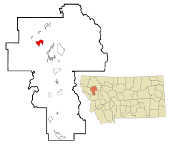
 Location of Big Arm, Montana | |
| Coordinates: 47°48′8″N 114°16′51″W / 47.80222°N 114.28083°W | |
| Country | United States |
| State | Montana |
| County | Lake |
| Area | |
| • Total | 5.42 sq mi (14.03 km2) |
| • Land | 5.42 sq mi (14.03 km2) |
| • Water | 0.00 sq mi (0.00 km2) |
| Elevation | 2,953 ft (900 m) |
| Population (2020) | |
| • Total | 218 |
| • Density | 40.23/sq mi (15.53/km2) |
| Time zone | UTC-7 (Mountain (MST)) |
| • Summer (DST) | UTC-6 (MDT) |
| ZIP code | 59910 |
| Area code | 406 |
| FIPS code | 30-05800 |
| GNIS feature ID | 0768742 |
Big Arm is a census-designated place (CDP) in Lake County, Montana, United States. The population was 177 at the 2010 census,[2] up from 131 in 2000.
The town is situated on the south side of Big Arm, a large bay on Flathead Lake, hence its name. The name was used by the Kootenai people, who lived there prior to the town being established.[3] The post office opened in 1911, with Marion F. Lamb as postmaster.[4]
Big Arm State Park is located just north of the town.
- ^ "ArcGIS REST Services Directory". United States Census Bureau. Retrieved September 5, 2022.
- ^ "Total Population: 2010 Census DEC Summary File 1 (P1), Big Arm CDP, Montana". data.census.gov. U.S. Census Bureau. Retrieved April 15, 2020.
- ^ "Montana Place Names Companion". Montana Historical Society. Retrieved July 22, 2017.
- ^ Carkeek Cheney, Roberta (1983). Names on the Face of Montana. Missoula, Montana: Mountain Press Publishing Company. p. 5. ISBN 0-87842-150-5.