| Big Bald Mountain | |
|---|---|
 Big Bald Mountain, viewed from the Bear Rock Ridge Bed and Breakfast | |
| Highest point | |
| Elevation | 4,055 ft (1,236 m)[1] |
| Prominence | 1,755 ft (535 m)[2] |
| Listing | Highest point in Gilmer County[2] |
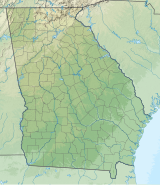
| Coordinates | 34°45′05″N 84°19′14″W / 34.7514718°N 84.3206112°W[1] |
| Geography | |
| Location | Chattahoochee National Forest |
| Parent range | Blue Ridge Mountains |
| Topo map(s) | USGS Blue Ridge, GA |
Big Bald Mountain is the highest peak in Gilmer County, Georgia, U.S. and is in the Rich Mountain Wilderness, which is administered as a component of the Chattahoochee National Forest.
- ^ a b "Big Bald Mountain". Geographic Names Information System. United States Geological Survey, United States Department of the Interior. Retrieved 2024-05-01.
- ^ a b "Big Bald Mountain, Georgia". Peakbagger.com. Retrieved 2024-05-01.
