| Big South Fork National River and Recreation Area | |
|---|---|
| Big South Fork | |
 Rock bluffs overlooking the Cumberland River in Big South Fork | |
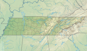
| Location | Scott, Fentress, Pickett, and Morgan counties in Tennessee, and McCreary County, Kentucky, United States |
| Nearest city | Oneida, Tennessee, and Whitley City, Kentucky |
| Coordinates | 36°29′11″N 84°41′55″W / 36.4865°N 84.6985°W |
| Area | 125,310 acres (50,710 ha)[1] |
| Established | March 7, 1974 |
| Visitors | 797,726 (in 2022)[2] |
| Governing body | National Park Service |
| Website | https://www.nps.gov/biso/ |
The Big South Fork National River and Recreation Area, commonly known as Big South Fork, preserves the Big South Fork of the Cumberland River and its tributaries in northeastern Tennessee and southeastern Kentucky.
Within it are reminders of the time when the area was subjected to logging and mining expansion. The community of No Business was located by No Business Creek in Tennessee; first settled in 1796, it had been abandoned by late 1960.[3] In addition, the former mining community of Blue Heron, Kentucky is preserved and interpreted via signage.
The Big South Fork region contains one of the highest concentrations of natural bridges in the eastern United States and the area is located in parts of Scott, Fentress, Pickett, and Morgan counties in Tennessee, and McCreary County in Kentucky. Charit Creek Lodge is a wilderness lodge, accessible by trail, located within the park.[4]
The Big South Fork was also legally designated a Kentucky Wild River by the Kentucky General Assembly through the Office of Kentucky Nature Preserves' Wild Rivers Program.
- ^ "Listing of acreage – December 31, 2011" (XLSX). Land Resource Division, National Park Service. Retrieved 2012-12-16. (National Park Service Acreage Reports)
- ^ "NPS Annual Recreation Visits Report". National Park Service. Retrieved August 2, 2023.
- ^ "No Business". National Park Service. Retrieved 5 May 2021.
- ^ "Charit Creek Lodge Big South Fork". Archived from the original on 2014-05-17. Retrieved 2014-05-01.

