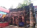
Birbhum district (IPA: [biːrbʰuːm]) is an administrative unit in the Indian state of West Bengal. It is the northernmost district of Burdwan division—one of the five administrative divisions of West Bengal. The district headquarters is in Suri. Other important cities are Bolpur, Rampurhat and Sainthia.[4][5] Jamtara, Dumka and Pakur districts of the state of Jharkhand lie at the western border of this district; the border in other directions is covered by the districts of Bardhaman of Purba Bardhaman, Paschim Bardhaman and Murshidabad of West Bengal.
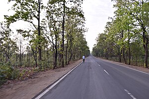
Often called "the land of red soil",[6] Birbhum is noted for its topography and its cultural heritage which is somewhat different from the other districts in West Bengal. The western part of Birbhum is a bushy region, a part of the Chota Nagpur Plateau. This region gradually merges with the fertile alluvial farmlands in the east.[7]
This district saw many cultural and religious movements in history. The Visva Bharati University at Santiniketan, established by Rabindranath Tagore, is one of the places Birbhum is known for.[8] Many festivals are celebrated in the district, including Poush Mela.[9]
Birbhum is primarily an agricultural district with around 75.09% of the population being dependent on agriculture.[10] Principal industries of the district include cotton and silk harvesting and weaving, rice and oilseed milling, lac harvesting, stone mining and metalware and pottery manufacture.[11] Bakreshwar Thermal Power Station is the only heavy industry in the district.[12]
- ^ "DM Desk". Birbhum District, Government of West Bengal. Retrieved 5 November 2024.
- ^ a b "Fact and Figures". Wb.gov.in. Retrieved 5 July 2019.
- ^ "52nd Report of the Commissioner for Linguistic Minorities in India" (PDF). Nclm.nic.in. Ministry of Minority Affairs. p. 85. Archived from the original (PDF) on 25 May 2017. Retrieved 5 July 2019.
- ^ "Directory of District, Sub division, Panchayat Samiti/ Block and Gram Panchayats in West Bengal, March 2008". West Bengal. National Informatics Centre, India. 19 March 2008. p. 1. Archived from the original on 25 February 2009. Retrieved 28 February 2009.
- ^ "Birbhum District History". District Administration. Archived from the original on 10 November 2021. Retrieved 18 February 2009.
- ^ Rahim, Kazi MB, and Sarkar, Debasish, Agriculture, Technology, Products and Markets of Birbhum District, Paschim Banga, Birbhum Special Issue, pp. 157–166, Information and Cultural Department, Government of West Bengal.
- ^ Mukhopadhyay, Malay, Birbhum Jelar Bhougolik Parichiti, Paschim Banga, Birbhum Special issue (in Bengali), February 2006, pp. 29–32.
- ^ Halim, Abdul, Birbhumer Sech Byabastha O Samaj Unnayan Parikalpana Samparke, Paschim Banga, Birbhum Special issue (in Bengali), February 2006, pp. 149–155.
- ^ Mukhopadhyay, Aditya, Birbhumer Mela, Paschim Banga, Birbhum Special issue (in Bengali), February 2006, pp. 203–214.
- ^ Cite error: The named reference
paschim4was invoked but never defined (see the help page). - ^ Cite error: The named reference
paschim1was invoked but never defined (see the help page). - ^ Pramanik, Swarajit, Birbumer Ahankar: Bakreshwar Tapbidyut Kendra, Paschim Banga, Birbhum Special issue (in Bengali), February 2006, pp. 189–192.


