Birecik | |
|---|---|
District and municipality | |
 | |
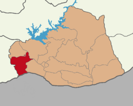
 Map showing Birecik District in Şanlıurfa Province | |
| Coordinates: 37°01′30″N 37°58′37″E / 37.02500°N 37.97694°E | |
| Country | Turkey |
| Province | Şanlıurfa |
| Government | |
| • Mayor | Mehmet Begit[1][2] (Ind.) |
| • Kaymakam | Mustafa Gürbüz[3] |
Area | 912 km2 (352 sq mi) |
| Elevation | 450 m (1,480 ft) |
| Population (2023)[4] | 93,866 |
| • Density | 100/km2 (270/sq mi) |
| Time zone | UTC+3 (TRT) |
| Postal code | 63400 |
| Area code | 0414 |
| Website | www |
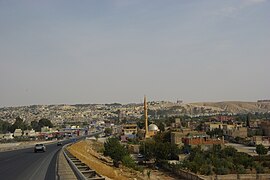
Birecik[a] is a municipality and district of Şanlıurfa Province, Turkey.[8] Its area is 912 km2,[9] and its population is 93,866 (2023).[4] It lies on the Euphrates.
Built on a limestone cliff 400 ft. high on the left/east bank of the Euphrates, "at the upper part of a reach of that river, which runs nearly north-south, and just below a sharp bend in the stream, where it follows that course after coming from a long reach flowing more from the west".[10]
- ^ TRT Haber Şanlıurfa Birecik Seçim Sonuçları Retrieved 5 May 2024.
- ^ Şanlıurfa Birecik Belediye Başkanı İstifa Etti Retrieved 5 May 2024.
- ^ Birecik Kaymakamlığı Retrieved 5 May 2024.
- ^ a b "Address-based population registration system (ADNKS) results dated 31 December 2023, Favorite Reports" (XLS) (in Turkish). TÜİK. Retrieved 10 May 2024.
- ^ Minasyan, Mihran. "Antep-Fotoğrafçılar". houshamadyan. Retrieved 1 December 2021.
- ^ Cite error: The named reference
Streckwas invoked but never defined (see the help page). - ^ İbrahim Sediyani (2009). Adını arayan coğrafya. Özedönüş Yayınları. p. 187. ISBN 9786054296002.
- ^ Büyükşehir İlçe Belediyesi, Turkey Civil Administration Departments Inventory. Retrieved 19 September 2023.
- ^ "İl ve İlçe Yüz ölçümleri". General Directorate of Mapping. Retrieved 19 September 2023.
- ^ William Smith, Dictionary of Greek and Roman Geography (1854)
Cite error: There are <ref group=lower-alpha> tags or {{efn}} templates on this page, but the references will not show without a {{reflist|group=lower-alpha}} template or {{notelist}} template (see the help page).

