Birkdale | |
|---|---|
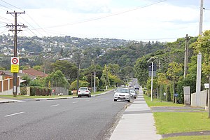
 Looking north from Salisbury Road, Birkdale | |
 | |
| Coordinates: 36°48′02″S 174°42′15″E / 36.8006°S 174.7042°E | |
| Country | New Zealand |
| City | Auckland |
| Local authority | Auckland Council |
| Electoral ward | North Shore Ward |
| Local board | Kaipātiki Local Board |
| Area | |
| • Land | 290 ha (720 acres) |
| Population (June 2023)[2] | |
| • Total | 9,460 |
| Postcode(s) | 4159 |
| Beach Haven | Beach Haven | Glenfield |
| (Waitematā Harbour) |
|
Birkenhead |
| (Waitematā Harbour) | Chatswood | Birkenhead |
Birkdale is a suburb of the contiguous Auckland metropolitan area located in New Zealand. Originally called Parkview, comprising the area from Balmain Rd to the Birkdale (now Beach Haven) wharf, it was renamed Birkdale at a meeting of the Birkenhead Borough Council in 1889, after the suburb of Birkenhead in England of the same name.[3][4] It now comprises statistical area units such as 'Birkdale North' and 'Birkdale South'. The suburb is located in the North Shore, and is under the governance of Auckland Council.
- ^ Cite error: The named reference
Areawas invoked but never defined (see the help page). - ^ "Population estimate tables - NZ.Stat". Statistics New Zealand. Retrieved 25 October 2023.
- ^ McClure, Margaret (1987). The Story of Birkenhead, Birkenhead City Council
- ^ "Place name detail: 427". New Zealand Gazetteer. New Zealand Geographic Board.