| Bishop Wilton Wold | |
|---|---|
 The summit | |
| Highest point | |
| Elevation | 248 m (814 ft)[1] |
| Prominence | c. 203 m |
| Listing | Marilyn, County Top |
| Coordinates | 54°00′06″N 0°45′02″W / 54.00163°N 0.75049°W |
| Geography | |
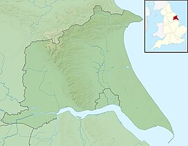
Bishop Wilton Wold in the East Riding of Yorkshire | |
| Location | Yorkshire Wolds, England |
| OS grid | SE820569 |
| Topo map | OS Landranger 106 |
Bishop Wilton Wold is the highest point of the Yorkshire Wolds in the East Riding of Yorkshire, England. The summit, known as Garrowby Hill, lies about five miles (eight kilometres) north of Pocklington.[2]
As with most of the wolds, it is wide, flat and agricultural in nature. The A166 road passes right by the top. However, it is a Marilyn (having topographic prominence of at least 150 m or 492 ft 2 in). There is a trig point, two covered reservoirs and an aerial.
Topography detailed from LIDAR info, in the database of British Hills, gives the summit as 247.9 metres (813 ft) on the tumulus north of the A166 road just to the east of the 246-metre (807 ft) OS map height given for the triangulation pillar that is within the reservoir.[3] The prominence is 207.2m with col of 40.7m at TA 1103 7869 as detailed in the database of British Hills.
The British artist David Hockney painted the view from the summit in 1998.
- ^ Bathurst, David (2012). Walking the county high points of England. Chichester: Summersdale. pp. 69–75. ISBN 978-1-84-953239-6.
- ^ "Bishop Wilton, East Yorkshire - Local History". pocklingtonhistory.com. Retrieved 15 April 2023.
- ^ "Mountain Search". Retrieved 9 September 2023.
