| Bjni Fortress Բջնի բերդ | |
|---|---|
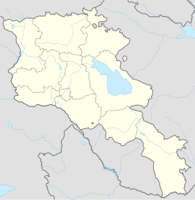
| Kotayk Province, Armenia | |
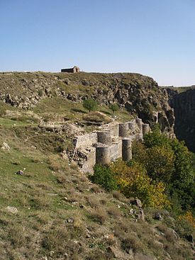
 Remains of the fortification walls at Bjni, October 2009. | |
| Coordinates | 40°27′39″N 44°39′16″E / 40.4607°N 44.6544°E |
| Type | Fortress |
| Site information | |
| Controlled by | Pahlavuni family from the 11th to 13th century; Zakharyan family from the 13th to late 14th century |
| Open to the public | Yes; ask a local near the hill to show the easiest route up (there are two routes). |
| Condition | Some of the exterior fortress walls survive in relatively poor condition. |
| Site history | |
| Built | From the 9th to 10th century |
| Built by | Pahlavuni family of the Bagratuni dynasty |
| In use | As a fortress by the Pahlavuni family and possibly the Zakharyan family as well |
| Materials | Stone |
| Demolished | Quite possibly during the destruction of the village of Bjni by the Turko-Mongol conqueror Timur Lenk in 1387–1388 |
Bjni Fortress (Armenian: Բջնի բերդ) is a medieval Armenian fortress located in the village of Bjni in the Kotayk Province of Armenia. It sits upon the top and along the sides of a mesa that divides the village nearly in half. The larger portion of which is located west of the mesa and curves south, while a smaller portion is east. The walls of the fortress may only be seen from the western side of the village, and are easiest reached via a narrow dirt road that forks (take the left fork) and goes up the side of the hill past some residences. Bjni Fortress is 1,504 metres (4,934 ft) above sea level.[1]
- ^ "Bjni Fortress Altitude and Location". Archived from the original on 2015-09-23. Retrieved 2014-09-13.
