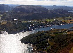
Bjugn Municipality
Bjugn kommune | |
|---|---|
 | |
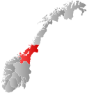
 Trøndelag within Norway | |
 Bjugn within Trøndelag | |
| Coordinates: 63°48′24″N 09°53′53″E / 63.80667°N 9.89806°E | |
| Country | Norway |
| County | Trøndelag |
| District | Fosen |
| Established | 1853 |
| • Preceded by | Ørland Municipality |
| Disestablished | 1 Jan 2020 |
| • Succeeded by | Ørland Municipality |
| Administrative centre | Botngård |
| Government | |
| • Mayor (2014–2019) | Ogne Undertun (Ap) |
| Area (upon dissolution) | |
• Total | 383.82 km2 (148.19 sq mi) |
| • Land | 355.85 km2 (137.39 sq mi) |
| • Water | 27.97 km2 (10.80 sq mi) 7.3% |
| • Rank | #245 in Norway |
| Highest elevation | 492.5 m (1,615.8 ft) |
| Population (2019) | |
• Total | 4,904 |
| • Rank | #205 in Norway |
| • Density | 12.8/km2 (33/sq mi) |
| • Change (10 years) | |
| Demonym | Bjugning[2] |
| Official language | |
| • Norwegian form | Bokmål |
| Time zone | UTC+01:00 (CET) |
| • Summer (DST) | UTC+02:00 (CEST) |
| ISO 3166 code | NO-5017[4] |
Bjugn is a former municipality in Trøndelag county, Norway. The municipality existed from 1853 until its dissolution in 2020 when it was merged into Ørland Municipality. It was part of the Fosen region. The village of Botngård was the administrative centre of Bjugn Municipality. Other villages in Bjugn included Høybakken, Jøssund, Lysøysundet, Nes, Oksvoll, and Vallersund.[5] Bjugn was on the Robek-list in 2015.[6]
At the time of its dissolution in 2020, the 384-square-kilometre (148 sq mi) municipality was the 245th largest by area out of the 422 municipalities in Norway. Bjugn was the 205th most populous municipality in Norway with a population of 4,904. The municipality's population density was 12.8 inhabitants per square kilometre (33/sq mi) and its population had increased by 8% over the last decade.[7][8]
- ^ "Høgaste fjelltopp i kvar kommune" (in Norwegian). Kartverket. 16 January 2024.
- ^ "Navn på steder og personer: Innbyggjarnamn" (in Norwegian). Språkrådet.
- ^ "Forskrift om målvedtak i kommunar og fylkeskommunar" (in Norwegian). Lovdata.no.
- ^ Bolstad, Erik; Thorsnæs, Geir, eds. (26 January 2023). "Kommunenummer". Store norske leksikon (in Norwegian). Kunnskapsforlaget.
- ^ Haugen, Morten, ed. (17 June 2017). "Bjugn". Store norske leksikon (in Norwegian). Kunnskapsforlaget. Retrieved 2 October 2017.
- ^ "(+)– Dette løfter oss ut av Robek". 23 February 2016.
- ^ Statistisk sentralbyrå (2018). "Table: 06913: Population 1 January and population changes during the calendar year (M)" (in Norwegian). Retrieved 12 March 2019.
- ^ Statistisk sentralbyrå. "09280: Area of land and fresh water (km²) (M)" (in Norwegian). Retrieved 12 March 2019.

