| Black Mountains | |
|---|---|
 The Black Mountains immersed in a snowstorm | |
| Highest point | |
| Peak | Mount Mitchell |
| Elevation | 6,684[1] ft (2,037 m) |
| Coordinates | 35°45′53″N 82°15′55″W / 35.76472°N 82.26528°W |
| Geography | |
| Country | United States |
| State | North Carolina |
| Parent range | Blue Ridge Mountains |
| Geology | |
| Orogeny | Alleghenian |
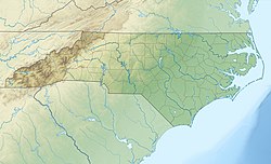
The Black Mountains are a mountain range in western North Carolina, in the southeastern United States. They are part of the Blue Ridge Province of the Southern Appalachian Mountains. The Black Mountains are the highest mountains in the Eastern United States. The range takes its name from the dark appearance of the red spruce and Fraser fir trees that form a spruce-fir forest on the upper slopes which contrasts with the brown (during winter) or lighter green (during the growing season) appearance of the deciduous trees at lower elevations. The Eastern Continental Divide, which runs along the eastern Blue Ridge crest, intersects the southern tip of the Black Mountain range.
The Black Mountains are home to Mount Mitchell State Park, which protects the range's highest summits in the central section of the range. Much of the range is also protected by the Pisgah National Forest. The Blue Ridge Parkway passes along the range's southern section, and is connected to the summit of Mount Mitchell by North Carolina Highway 128. The Black Mountains are mostly located in Yancey County, although the range's southern and western extremes run along the Buncombe County line.
- ^ "Data sheet". www.ents-bbs.org. Archived from the original on 2015-06-18. Retrieved 2021-03-09.
