| Black Mountains | |
|---|---|
| Highest point | |
| Peak | Mahogany Knoll, (northeastern east-west ridgeline)-Black Mountains |
| Elevation | 6,729 ft (2,051 m) |
| Coordinates | 37°18′14″N 113°33′15″W / 37.30389°N 113.55417°W |
| Dimensions | |
| Length | 30 mi (48 km) (30 x 28 mi, ridgeline west, two ridgelines to southwest-w/Long Hollow) |
| Width | 28 mi (45 km) E-W |
| Geography | |
| Country | United States |
| State | Utah |
| Counties | Iron and Beaver |
| Communities | Minersville, Enoch, Summit, Parowan, Paragonah, Greenville and Adamsville |
| Range coordinates | 38°05′21″N 112°50′04″W / 38.08914°N 112.83439°W |
| Borders on | Escalante Desert, Mineral Mountains, Minersville Reservoir, Beaver, Utah, Tushar Mountains, Parowan Valley, Hurricane Cliffs, Hurricane Cliffs and Markagunt Plateau |
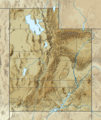
The Black Mountains is a 30-mile (48 km) long mountain range in northeastern Iron County and southeastern Beaver County in southwestern Utah, United States.[1][2]
The range borders the northeast portion of the Escalante Desert, and the range's southeast flank trends with the Hurricane Cliffs and Parowan Valley. In the south section, of a southwest trending ridgeline, is the Parowan Gap Petroglyphs Site. At the terminus of the ridgeline, the pass at the Summit, Utah region, there is the site of the Old Spanish National Historic Trail as it crossed into the northeast of Cedar Valley, the site of Cedar City.
Interstate 15 (I-15) traverses the southeast region of the range from Cedar City, to Greenville-Beaver.
- ^ U.S. Geological Survey Geographic Names Information System: Black Mountains
- ^ Utah DeLorme Atlas & Gazetteer, p. 49, 50.
