This article relies largely or entirely on a single source. (July 2019) |
| Blackhand Gorge State Nature Preserve | |
|---|---|
 | |
| Location | Licking County, Ohio |
| Nearest city | Newark, Ohio |
| Coordinates | 40°03′22″N 82°14′54″W / 40.056°N 82.24847°W |
| Area | 957 acres (387 ha) |
| Established | 1975 |
| Governing body | Ohio Department of Natural Resources |
| naturepreserves | |
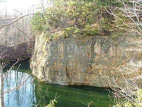
The Blackhand Gorge State Nature Preserve is a 4-mile-long (6.4 km) sandstone formation through which the Licking River flows in Licking County, Ohio, United States. Located 12 miles (19 km) east of Newark near the tiny town of Toboso, 957 acres (387 ha) along the gorge were designated an Ohio Nature Preserve in 1975. The gorge is a capsule of Ohio transportation history, having hosted canal boats, steam railroads, electric interurbans, and automobiles through the years. It is named for the black hand petroglyph that was found on the cliff face by the first settlers to the area. Black Hand Sandstone is a resistant rock that also forms the backbone of the Hocking Hills region.

