| Blaenffos | |
|---|---|
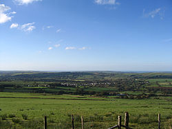
 Blaenffos viewed from the southeast | |
Location within Pembrokeshire | |
| OS grid reference | SN190371 |
| Community | |
| Principal area | |
| Country | Wales |
| Sovereign state | United Kingdom |
| Post town | Boncath |
| Postcode district | SA37 |
| Dialling code | 01239 |
| Police | Dyfed-Powys |
| Fire | Mid and West Wales |
| Ambulance | Welsh |
| UK Parliament | |
| Senedd Cymru – Welsh Parliament | |
Blaenffos is a small village of around 200 inhabitants in the north of Pembrokeshire, Wales, in the community of Boncath. It sits on the boundary between the former parishes of Llanfihangel Penbedw and Castellan Chapelry (part of Penrydd parish).
Lying one mile to the north of Crymych, Blaenffos has an average elevation of 200 metres (660 ft), lying on the western slopes of Y Frenni which at 395 metres (1,296 ft) is the most easterly peak in the Preseli Hills.[1] The village straddles the A478 former drovers' road which runs from Cardigan in Ceredigion south to Tenby, is surrounded by farmland, and is in the heart of Welsh-speaking Pembrokeshire with a rich history and associated folklore.
- ^ Ordnance Survey: Landranger Series: Sheet 145. 2007.
