| Blindbothel | |
|---|---|
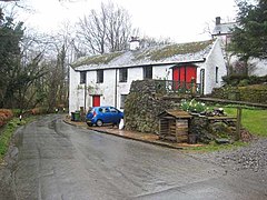
 Aikbank Mill, Blindbothel | |
| Population | 174 (2011) |
| OS grid reference | NY118274 |
| Civil parish |
|
| Unitary authority | |
| Ceremonial county | |
| Region | |
| Country | England |
| Sovereign state | United Kingdom |
| Post town | COCKERMOUTH |
| Postcode district | CA13 |
| Dialling code | 01228 01900 |
| Police | Cumbria |
| Fire | Cumbria |
| Ambulance | North West |
| UK Parliament | |
Blindbothel is a village and civil parish in Cumbria, England. It is on the edge of the Lake District National Park, and is a couple of miles south of Cockermouth. It had a population of 174 according to the 2011 census.[1] Blindbothel has an area of around 500 hectares (1,200 acres)[2] On the East of Blindbothel is the River Cocker which flows to Cockermouth.[3]
In the 1870s Blindbothel was described as
- "Blindbothel, a township in Brigham parish, Cumberland; 2 miles W of Cockermouth. Real property, £1,206. Pop., 116. Houses, 19."[4]
- ^ "Blindbothel (Parish): Key Figures for 2011 Census: Key Statistics". Neighbourhood Statistics; population. Office for National Statistics. Archived from the original on 20 December 2016. Retrieved 10 February 2016.
- ^ "Blindbothel". Melbreak Communities. 19 May 2010. Retrieved 8 May 2013.
- ^ "Blindbothel". melbreak communities. 19 May 2010. Retrieved 8 May 2013.
- ^ Marius, John (1870–1872). Imperial Gazetteer of England and Wales (1st ed.). Cumberland: Marius. Retrieved 4 February 2013.

