| Blood Mountain | |
|---|---|
 Blood Mountain (L) and Slaughter Mountain (R), as seen from Brasstown Bald | |
| Highest point | |
| Elevation | 4,452 ft (1,357 m)[1] |
| Prominence | 1,480 ft (450 m)[2] |
| Listing | Mountains of Georgia |
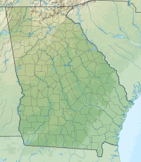
| Coordinates | 34°44′23″N 83°56′14″W / 34.7398487°N 83.9370913°W[1] |
| Geography | |
| Parent range | Blue Ridge Mountains |
| Topo map | USGS Neel Gap[1] |
| Climbing | |
| First ascent | unknown |
| Easiest route | Appalachian Trail, other trails |
Blood Mountain is the highest peak on the Georgia section of the Appalachian Trail and the sixth-tallest mountain in Georgia, with an elevation of 4,458 feet (1,359 m).[3][4] It is located on the border of Lumpkin County with Union County and is within the boundaries of the Chattahoochee National Forest and the Blood Mountain Wilderness. There are several waterfalls, hiking trails and other recreational areas in the vicinity. This mountain marks the southernmost range limit for many Northern and Appalachian species, especially for plant species.
Blood Mountain is the high point of the Apalachicola River watershed via the Chattahoochee River.
- ^ a b c "Blood Mountain". Geographic Names Information System. United States Geological Survey, United States Department of the Interior. Retrieved 2024-04-24.
- ^ https://www.peakbagger.com/peak.aspx?pid=7737 [bare URL]
- ^ Cite error: The named reference
hmdbwas invoked but never defined (see the help page). - ^ Brown (1996), p.93
