Blue Bell | |
|---|---|
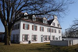
 Normandy Farmstead | |
| Coordinates: 40°08′41″N 75°16′08″W / 40.14472°N 75.26889°W | |
| Country | United States |
| State | Pennsylvania |
| County | Montgomery |
| Township | Whitpain |
| Area | |
• Total | 5.39 sq mi (13.96 km2) |
| • Land | 5.39 sq mi (13.96 km2) |
| • Water | 0.00 sq mi (0.00 km2) |
| Elevation | 358 ft (109 m) |
| Population | |
• Total | 6,506 |
| • Density | 1,207.27/sq mi (466.10/km2) |
| Time zone | UTC-5 (EST) |
| • Summer (DST) | UTC-4 (EDT) |
| ZIP code | 19422 |
| Area codes | 215/267/445, 610/484 |
| FIPS code | 42-07224 |
Blue Bell is a census-designated place (CDP) in Whitpain Township, Pennsylvania, United States. As of the 2010 census, its population was 6,067.
Blue Bell was originally known as Pigeontown, after the large flocks of the now-extinct passenger pigeons that once gathered there. The town was renamed in 1840 after the historically prominent Blue Bell Inn.
Blue Bell is known for its large executive-style mansions, major business parks, community shopping facilities, and small businesses. It is one of the most affluent areas outside the Main Line communities in the Philadelphia area. In July 2005, Money magazine ranked Blue Bell 14th on its list of the "100 Best Places to Live in the United States".[3]
- ^ "ArcGIS REST Services Directory". United States Census Bureau. Retrieved October 12, 2022.
- ^ Cite error: The named reference
USCensusDecennial2020CenPopScriptOnlywas invoked but never defined (see the help page). - ^ "Best Places to Live 2005". CNN.

