| Blue Mesa Reservoir | |
|---|---|
 | |
| Location | Gunnison County, Colorado |
| Coordinates | 38°28′13″N 107°13′13″W / 38.4703°N 107.2204°W |
| Type | reservoir |
| Primary inflows | Gunnison River, Lake Fork Arm of the Gunnison River, Soap Creek, Cebolla Creek |
| Primary outflows | Gunnison River |
| Basin countries | United States |
| Max. length | 20 mi (32 km) |
| Surface area | 9,180 acres (3,720 ha) |
| Water volume | 940,800 acre-feet (1,160.5 GL) |
| Shore length1 | 96 mi (154 km) |
| Surface elevation | 7,519 ft (2,292 m) |
| 1 Shore length is not a well-defined measure. | |
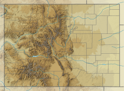
Blue Mesa Reservoir is an artificial reservoir located on the upper reaches of the Gunnison River in Gunnison County, Colorado. The largest lake located entirely within the state, Blue Mesa Reservoir was created by the construction of Blue Mesa Dam, a 390 feet (120 m) tall earthen fill dam constructed on the Gunnison by the U.S. Bureau of Reclamation in 1966 for the generation of hydroelectric power.[1] Managed as part of the Curecanti National Recreation Area, a unit of the National Park Service, Blue Mesa Reservoir is the largest lake trout and Kokanee salmon fishery in Colorado.[2]
- ^ Region, Bureau of Reclamation Upper Colorado. "CRSP, Blue Mesa Dam - Reclamation, Upper Colorado Region". www.usbr.gov. Archived from the original on 2016-09-29. Retrieved 2017-05-24.
- ^ Reclamation, Bureau of. "Aspinall Unit - UC Region - Bureau of Reclamation". www.usbr.gov.

