This article needs additional citations for verification. (December 2007) |
| Blue Mountains | |
|---|---|
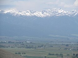
 Baker City, Oregon, with the Blue Mountains in the background, seen from the National Historic Oregon Trail Interpretive Center observatory | |
| Highest point | |
| Peak | Rock Creek Butte[1][2] |
| Elevation | 9,106 ft (2,776 m) |
| Coordinates | 44°49′00″N 118°06′13″W / 44.81667°N 118.10361°W[3] |
| Dimensions | |
| Area | 15,000 sq mi (39,000 km2) |
| Geography | |
 | |
| Country | United States |
| States | Oregon, Washington |
The Blue Mountains are a mountain range in the northwestern United States, located largely in northeastern Oregon and stretching into extreme southeastern Washington. The range has an area of about 15,000 square miles (39,000 km2), stretching east and southeast of Pendleton, Oregon, to the Snake River along the Oregon–Idaho border.[4]
The Blue Mountains cover ten counties across two states; they are Union, Umatilla, Grant, Baker, Wallowa and Harney counties in Oregon, and Walla Walla, Columbia, Garfield and Asotin counties in Washington.[5] The mountains are unique as the home of the world's largest living organism, a subterranean colonial mycelial mat of the fungus Armillaria ostoyae.[6] The Blue Mountains were named after the color of the mountains when seen from a distance and the blue hue imparted by the smoke of forest and range fires set by Indigenous people as management tools in the fall.[7]
- ^ "Blue Mountains (OR)". summitpost.org. Retrieved 2021-02-05.
- ^ "Rock Creek Butte, Oregon". Peakbagger.com. Retrieved August 23, 2022.
- ^ "Rock Creek Butte". Geographic Names Information System. United States Geological Survey, United States Department of the Interior. November 28, 1980. Retrieved August 23, 2022.
- ^ "Blue Mountains". www.oregonencyclopedia.org.
- ^ "Blue Mountains". Geographic Names Information System. United States Geological Survey, United States Department of the Interior. 1986-05-22. Retrieved 2014-09-21.
- ^ Casselman, Anne. "Strange but True: The Largest Organism on Earth Is a Fungus". Scientific American. Retrieved 2017-06-14.
- ^ Shinn, Dean (1980). "Historical perspectives on range burning in the inland Pacific Northwest". Journal of Range Management. 33 (6): 415–423. doi:10.2307/3898574. hdl:10150/646358. JSTOR 3898574.