| Blue Ridge Mountains | |
|---|---|
 | |
| Highest point | |
| Peak | Mount Mitchell |
| Elevation | 6,684 ft (2,037 m) |
| Coordinates | 35°45′53″N 82°15′55″W / 35.76472°N 82.26528°W |
| Geography | |
| Country | United States |
| States | |
| Parent range | Appalachian Mountains |
| Geology | |
| Orogeny | Grenville orogeny |
| Rock types |
|
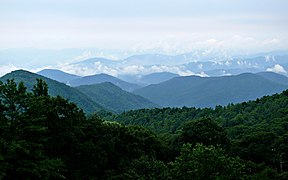
The Blue Ridge Mountains are a physiographic province of the larger Appalachian Highlands range. The mountain range is located in the Eastern United States and extends 550 miles southwest from southern Pennsylvania through Maryland, West Virginia, Virginia, North Carolina, South Carolina, Tennessee, and Georgia.[1] The province consists of northern and southern physiographic regions, which divide near the Roanoke River gap.[2] To the west of the Blue Ridge, between it and the bulk of the Appalachians, lies the Great Appalachian Valley, bordered on the west by the Ridge and Valley province of the Appalachian range.
The Blue Ridge Mountains are known for having a bluish color when seen from a distance. Trees put the "blue" in Blue Ridge, from the isoprene released into the atmosphere.[3] This contributes to the characteristic haze on the mountains and their perceived color.[4]
Within the Blue Ridge province are two major national parks: the Shenandoah National Park in the northern section and the Great Smoky Mountains National Park in the southern section. The Blue Ridge Parkway, a 469-mile (755 km) long scenic highway, connects the two parks and runs along the ridge crest-lines, as does the Appalachian Trail.[5] Eight national forests include George Washington and Jefferson, Cherokee, Pisgah, Nantahala and Chattahoochee.
- ^ "Blue Ridge". U.S. Geological Survey. Archived from the original on December 24, 2019. Retrieved December 19, 2018.
- ^ "Physiographic divisions of the conterminous U. S." U.S. Geological Survey. Archived from the original on December 5, 2007. Retrieved December 6, 2007.
- ^ Johnson, A. W. (1998). Invitation To Organic Chemistry. Jones & Bartlett Learning. p. 261. ISBN 978-0-7637-0432-2.
blue mountains chemical terpene.
- ^ "Blue Ridge Parkway, Frequently Asked Questions". National Park Service. 2007. Archived from the original on December 28, 2007. Retrieved December 29, 2007.
- ^ Leighty, Dr. Robert D. (2001). "Blue Ridge Physiographic Province". Contract Report. Defense Advanced Research Projects Agency (DOD) Information Sciences Office. Archived from the original on May 21, 2008. Retrieved December 29, 2007.
