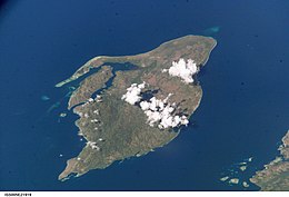
 Boano from the ISS space station | |
 | |
| Geography | |
|---|---|
| Location | Seram Sea |
| Coordinates | 2°59′S 127°55′E / 2.983°S 127.917°E |
| Archipelago | Maluku Islands |
| Area | 134 km2 (52 sq mi) |
| Highest elevation | 624 m (2047 ft) |
| Administration | |
| Province | Maluku |
| Regency | West Seram Regency |
| Demographics | |
| Population | 10028 (2020 Census) |
| Pop. density | 74.8/km2 (193.7/sq mi) |
| Languages | Ambonese Malay, Boano, Indonesian, Luhu |
| Additional information | |
| Time zone | |
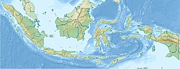
Boano Island is an island in West Seram Regency, Maluku Province, Indonesia. It is located off the northern coast of the Hoamoal Peninsula at the western end of Seram Island, across the Boano Strait. The inhabitants speak the Boano and Luhu languages, as well as Indonesian and Ambonese Malay.[1]
Pua Island (Pulau Pua), highest point 403 m, is located close off Boano's northwestern tip.[2]
- ^ "Ethnologue 15 report for Indonesia (Maluku)". Archived from the original on 2014-02-26. Retrieved 2013-05-14.
- ^ Pub164, 2004 Sailing Directions (Enroute): New Guinea
