| Boeng Tonle Chhmar | |
|---|---|
IUCN category IV (habitat/species management area)[1] | |
| Location | Kampong Thom Province, Cambodia |
| Nearest city | Pursat |
| Coordinates | 12°49′8″N 104°16′35″E / 12.81889°N 104.27639°E |
| Area | 145.6 km2 (56.2 sq mi) |
| Established | January 1999 |
| Governing body | Cambodian Ministry of Environment |
| Official name | Boeng Chhmar and Associated River System and Floodplain |
| Designated | June 23, 1999 |
| Reference no. | 997[2] |
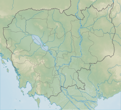
Boeng Tonle Chhmar is a 145.6 km2 (56.2 sq mi) large multiple use management area in Cambodia bordering Tonlé Sap lake that was established in 1999.[1] It is located in Peam Bang Commune in Kampong Thom Province.
Boeng Tonle Chhmar is a state owned sanctuary. The wildlife sanctuary consists of a lake surrounded by flooded forest on the north eastern side of the Tonle Sap lake. It contains areas of permanent open water, a system of small waterways and areas of flooded forest. In the wet season, Boeng Tonle Chhmar ceases to be a discrete lake and becomes part of the much enlarged Tonle Sap. The sanctuary is an example of near natural South Asian wetland. The area plays an important role in the hydrology and biology of two major river systems, the Stoung river and the Chikreng river. This area is home to a large number of diverse plant, fish, mammal and waterbird species. Many of these are listed as rare, vulnerable, or globally endangered. The Tonle Sap lake and its surrounding biosphere play a vital role in the Cambodian economy and several million depend on fish from the lake as a source of protein. Boeng Tonle Chhmar is one of three Ramsar Convention sites in Cambodia with the site number 997.[3]
- ^ a b Protected Planet (2018). "Boeng Tonle Chhmar". United Nations Environment World Conservation Monitoring Centre. Retrieved 26 Dec 2018.
- ^ "Boeng Chhmar and Associated River System and Floodplain". Ramsar Sites Information Service. Retrieved 25 April 2018.
- ^ "Summary Description CAMBODIA 2KH001". Wetlands International. 1999. Archived from the original on 2011-05-27. Retrieved 2009-04-25.
