Bogoro
Zaar (Sayawa) | |
|---|---|
LGA and town | |
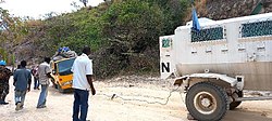
 MONUSCO vehicle towing out a local bus in 2022 | |
| Motto: Sohrgha Nanbong Yi Tuhd Lihbah? (Can a stick of broom sweep a place?) | |
 | |
| Country | |
| State | Bauchi State |
| Area | |
• Total | 322.2 sq mi (834.5 km2) |
| Population (2022)[1] | |
• Total | 149,700 |
| • Density | 460/sq mi (180/km2) |
| Time zone | UTC+1 (WAT) |
 | |
Bogoro is a Local Government Area of Bauchi State, Nigeria. Its headquarters are in the town of Bogoro. Za’ar or Sayawa people are the majority of its inhabitants.
It has an area of 894 km2 (345 sq mi) and a population of 84,215 at the 2006 census. The postal code of the area is 741.[2]
- ^ "Bauchi State: Subdivision". www.citypopulation.de. Retrieved 2024-02-05.
- ^ "Post Offices- with map of LGA". NIPOST. Archived from the original on 2012-11-26. Retrieved 2009-10-20.