This article needs additional citations for verification. (June 2020) |
Native name: Ilha de Bolama | |
|---|---|
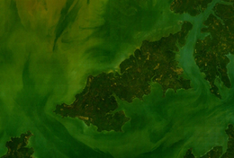
 Aerial image of Bolama | |
| Geography | |
| Location | Atlantic Ocean |
| Coordinates | 11°33′N 15°32′W / 11.550°N 15.533°W |
| Archipelago | Bissagos Islands |
| Area | 65 km2 (25 sq mi) |
| Administration | |
GNB | |
| Demographics | |
| Population | 6024 (2009)2009 census[1] |
| Pop. density | 93/km2 (241/sq mi) |
Bolama is the closest of the Bissagos Islands to the mainland of Guinea-Bissau. The island has a population of 6,024 (2009 census).[1] It shares its name with ist largest settlement, the town Bolama, which is the capital of the island and the Bolama Region.
It is almost surrounded by mangrove swamps and is known for its cashew nuts. Although often visited by local people, the island was apparently uninhabited[dubious – discuss] when British colonists settled it in 1792. Following a series of failures, they abandoned the island in 1794, another colonisation attempt in 1814 also being quickly ended.
- ^ a b População por região, sector e localidades por sexo censo 2009 Archived 2020-03-31 at the Wayback Machine, Instituto Nacional de Estatística Guiné-Bissau
