| Bolān Pass درۂ بولان | |
|---|---|
 A railway track traverses the pass | |
| Elevation | 1,793.4 m (5,884 ft) |
| Traversed by | |
| Location | Sibi, Pakistan |
| Range | Toba Kakar range |
| Coordinates | 29°27′13″N 67°29′41″E / 29.453516°N 67.494648°E |
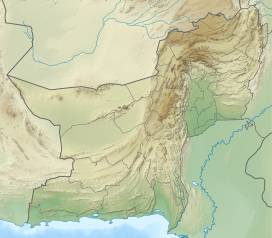
Bolan Pass (Urdu: درۂ بولان) is a valley and a natural gateway[2] through the Toba Kakar range[citation needed] in Balochistan province of Pakistan. It is situated 120 km (75 miles) south of Pakistan's border with Afghanistan. The pass is an 89 km (55 miles) stretch of the Bolan River valley from Rindli in the south to Darwāza near Kolpur in the north. It is made up of a number of narrow gorges and stretches.[2] It connects Quetta with Sibi by road and railway.
Being strategically located, it has also been used by traders, invaders, and nomadic tribes as a gateway to and from South Asia.[3] The Bolān Pass is an important pass on the Baluch frontier, connecting Jacobabad and Jhang with Multan, which has always occupied an important place in the history of British campaigns in Afghanistan.
The local population south of the pass predominantly consists of Brahvi tribes, who extend from Bolan Pass to Cape Monze on the Arabian Sea.[4][5] The ethnic group north of the pass consists of mainly Pashtuns, while to west, Balochis.[6]
- ^ PAK: Multitranche Financing Facility for the National Highway Development Sector Investment Program, Project 2 (MFF0002) (PDF). Prepared by Government of Pakistan for the Asian Development Bank (ADB). April 2009. p. 5 (6).
- ^ a b Bolān Pass, Encyclopædia Britannica 4 October 2014.
- ^ Singh, Sarina (2004). Pakistan & the Karakoram Highway (6th ed.). Lonely Planet. p. 112. ISBN 978-0-86442-709-0.
- ^ Minahan, James B. (31 August 2016), "Brahui", Encyclopedia of Stateless Nations: Ethnic and National Groups around the World, 2nd Edition: Ethnic and National Groups around the World, ABC-CLIO, pp. 79–80, ISBN 978-1-61069-954-9
- ^ Shah, Mahmood Ali (1992), Sardari, jirga & local government systems in Balochistan, Qasim Printers, pp. 6–7
- ^ Robert Markham, Sir Clements (1878). "The Geographical Magazine, Volume 5". The Geographical Magazine, Volume 5. Retrieved 10 March 2020.

