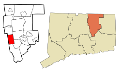
Bolton, Connecticut | |
|---|---|
 | |
| Motto: "A Town for All Seasons" | |
| Coordinates: 41°45′51″N 72°26′15″W / 41.76417°N 72.43750°W | |
| Country | |
| U.S. state | |
| County | Tolland |
| Region | Capitol Region |
| Incorporated | 1720 |
| Government | |
| • Type | Selectman-town meeting |
| • First selectman | Pam Sawyer (R) |
| • Selectmen | Robert R. Morra (R) Michael W. Eremita (R) Kimberly A. Miller (D) Nicole Sullivan (D) |
| Area | |
• Total | 14.7 sq mi (38.1 km2) |
| • Land | 14.4 sq mi (37.3 km2) |
| • Water | 0.3 sq mi (0.8 km2) |
| Elevation | 728 ft (222 m) |
| Population (2020)[1] | |
• Total | 4,858 |
| • Density | 330/sq mi (130/km2) |
| Time zone | UTC−5 (Eastern) |
| • Summer (DST) | UTC−4 (Eastern) |
| ZIP Code | 06043 |
| Area code(s) | 860/959 |
| FIPS code | 09-06260 |
| GNIS feature ID | 0213393 |
| List of auxiliary Interstate Highways | |
| U.S. Highways | |
| State Routes | |
| Website | town |
Bolton (/ˈboʊltən/ BOHL-tən) is a small rural town in Tolland County, Connecticut, United States. The population was 4,858 as of the 2020 census.[2] Bolton was incorporated in October 1720 and is governed by town meeting, with a first selectman and board of selectman as well as other boards serving specific functions. Bolton was named after a town of the same name in England, also located near Manchester.[3]
- ^ "Geographic Identifiers: 2010 Census Summary File 1 (G001): Bolton town, Tolland County, Connecticut". American Factfinder. U.S. Census Bureau. Archived from the original on February 13, 2020. Retrieved March 14, 2018.
- ^ "Census - Geography Profile: Bolton town, Tolland County, Connecticut". United States Census Bureau. Retrieved November 26, 2021.
- ^ The Connecticut Magazine: An Illustrated Monthly. Connecticut Magazine Company. 1903. p. 331. Archived from the original on April 27, 2018.


