| Bonneterre Formation | |
|---|---|
| Stratigraphic range: Guzhangian (Dresbachian) ~ | |
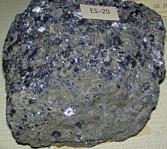
 Galena in Bonneterre Dolomite (Upper Cambrian; Missouri) | |
| Type | Formation |
| Underlies | Davis Formation |
| Overlies | Lamotte Sandstone[1] |
| Lithology | |
| Primary | Dolomite |
| Other | Shale, limestone, sandstone |
| Location | |
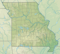
| Coordinates | 37°38′10″N 90°34′41″W / 37.636°N 90.578°W |
| Approximate paleocoordinates | 22°54′S 86°30′W / 22.9°S 86.5°W |
| Region | Arkansas,[2] Kansas,[3] Illinois, Iowa,[4] Minnesota,[4] Missouri |
| Country | |
The Bonneterre Formation is an Upper Cambrian geologic formation which outcrops in the St. Francois Mountains of the Missouri Ozarks. The Bonneterre is a major host rock for the lead ores of the Missouri Lead Belt.
- ^ Thompson 2001, p. 37.
- ^ Kurtz et al. 1975, p. 1.
- ^ Goebel 1968, p. 12.
- ^ a b Mossler 1987, p. 6.

