Boone County | |
|---|---|
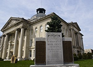
 Boone County Courthouse in Lebanon | |
 Location within the U.S. state of Indiana | |
 Indiana's location within the U.S. | |
| Coordinates: 40°03′N 86°28′W / 40.05°N 86.47°W | |
| Country | |
| State | |
| Founded | April 1, 1830 (created) 1831 (organized) |
| Named for | Daniel Boone |
| Seat | Lebanon |
| Largest city | Zionsville |
| Area | |
| • Total | 423.25 sq mi (1,096.2 km2) |
| • Land | 422.91 sq mi (1,095.3 km2) |
| • Water | 0.34 sq mi (0.9 km2) 0.08% |
| Population (2020) | |
| • Total | 70,812 |
| • Density | 170/sq mi (65/km2) |
| Congressional districts | 4th, 5th |
| Website | boonecounty |
| Indiana county number 6 | |
Boone County is a county in the U.S. state of Indiana. As of 2020, the population was 70,812.[1] The county seat is Lebanon.[2]
- ^ "Boone County, Indiana". United States Census Bureau. Retrieved May 29, 2023.
- ^ "Find a County". National Association of Counties. Archived from the original on May 31, 2011. Retrieved June 7, 2011.