| Borderland State Park | |
|---|---|
 Ames Mansion | |
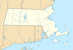
| Location | Easton, Sharon, Bristol, Norfolk, Massachusetts, United States |
| Coordinates | 42°04′03″N 71°09′13″W / 42.06750°N 71.15361°W[1] |
| Area | 1,843 acres (7.46 km2)[2] |
| Elevation | 207 ft (63 m)[1] |
| Established | 1971 |
| Operator | Massachusetts Department of Conservation and Recreation |
| Website | Borderland State Park |
Borderland Historic District | |
| Built | 1910 |
| Architect | Ames, Blanche Ames; Ames, Oakes |
| Architectural style | Late Gothic Revival, Georgian, Colonial Revival |
| NRHP reference No. | 97000497 |
| Added to NRHP | June 16, 1997 |
Borderland State Park is an American history and nature preserve with public recreational features located in the towns of Easton and Sharon, Massachusetts. The state park encompasses 1,843 acres (746 ha) surrounding the Ames Mansion, which was built in 1910. The area was listed on the National Register of Historic Places as Borderland Historic District in 1997. It is operated by the Massachusetts Department of Conservation and Recreation, with an appointed advisory council that participates in policy decision-making.[3]
- ^ a b "Borderland State Park". Geographic Names Information System. United States Geological Survey, United States Department of the Interior.
- ^ Cite error: The named reference
2012acreagelistwas invoked but never defined (see the help page). - ^ Cite error: The named reference
dcrwas invoked but never defined (see the help page).

