| Botany Bay | |
|---|---|
| Kamay/Gamay, Sting Ray Harbour[1] | |
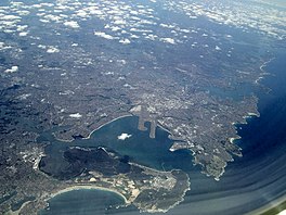
 Aerial photo of Sydney showing Botany Bay in the foreground. The two protrusions into the bay are runways of Sydney Airport. | |
 | |
| Location | Sydney, New South Wales, Australia |
| Coordinates | 33°59′59″S 151°13′59″E / 33.99972°S 151.23306°E |
| Type | Bay[2] |
| Primary inflows | Georges River, Cooks River |
| Primary outflows | Tasman Sea |
| Catchment area | 54.9 km2 (21.2 sq mi) |
| Max. length | 10 km (6.2 mi) |
| Surface area | 39.6 km2 (15.3 sq mi) |
| Average depth | 11.4 m (37 ft) |
| Water volume | 440,815,800 m3 (1.556726×10¹⁰ cu ft) |
| Website | NSW Environment & Heritage webpage |
Botany Bay (Dharawal: Kamay) is an open oceanic embayment,[2] located in Sydney, New South Wales, Australia, 13 km (8 mi) south of the Sydney central business district. Its source is the confluence of the Georges River at Taren Point and San Souci as well as the Cooks River at Kyeemagh, which flows 10 km (6 mi) to the east before meeting its mouth at the Tasman Sea, midpoint between the suburbs of La Perouse and Kurnell. The northern headland of the entrance to the bay from the Tasman Sea is Cape Banks, and, on the southern side, the outer headland is Cape Solander, and the inner headland is Sutherland Point.
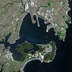
The total catchment area of the bay is approximately 55 km2 (21 sq mi). Despite its relative shallowness, the bay now serves as greater metropolitan Sydney's main cargo seaport, located at Port Botany, with facilities managed by Sydney Ports Corporation. Two runways of Sydney Airport extend into the bay, as do some port facilities. Kamay Botany Bay National Park is located on the northern and southern headlands of the bay. The area surrounding the bay is generally managed by Transport for NSW.
The land adjacent to Botany Bay was settled for many thousands of years by the Tharawal and Eora peoples and their associated clans. On 29 April 1770, Botany Bay was the site of James Cook's first landing of HMS Endeavour on the land mass of Australia, after his extensive navigation of New Zealand. Later the British planned Botany Bay as the site for a penal colony. Out of these plans came the first European habitation of Australia at Sydney Cove. Although the penal settlement was almost immediately shifted to Sydney Cove, for some time in Britain transportation to "Botany Bay" was a metonym for transportation to any of the Australian penal settlements.
- ^ "Settling on a name". National Museum of Australia. Retrieved 26 March 2023.
- ^ a b Roy, P. S.; Williams, R. J.; Jones, A. R.; Yassini, I.; et al. (2001). "Structure and Function of South-east Australian Estuaries". Estuarine, Coastal and Shelf Science. 53 (3): 351–384. Bibcode:2001ECSS...53..351R. doi:10.1006/ecss.2001.0796.
