Botrivier
Botla | |
|---|---|
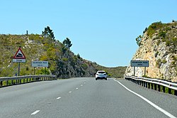
 The Houwhoek Pass near Botrivier. | |
| Coordinates: 34°13′33″S 19°12′18″E / 34.22583°S 19.20500°E | |
| Country | South Africa |
| Province | Western Cape |
| District | Overberg |
| Municipality | Theewaterskloof |
| Government | |
| • Counsellor | Pearl Stanfliet (DA) |
| Area | |
• Total | 1.93 km2 (0.75 sq mi) |
| Population (2011)[1] | |
• Total | 5,505 |
| • Density | 2,900/km2 (7,400/sq mi) |
| Racial makeup (2011) | |
| • Black African | 22.0% |
| • Coloureds | 68.6% |
| • Indian or Asian | 0.5% |
| • White | 7.4% |
| • Other | 1.5% |
| First languages (2011) | |
| • Afrikaans | 75.7% |
| • Xhosa | 14.9% |
| • English | 5.2% |
| • Sotho | 1.3% |
| • Other | 2.9% |
| Time zone | UTC+2 (SAST) |
| Postal code (street) | |
| PO box | 7185 |
| Area code | 028 |
Botrivier is a small town of approximately 10 000 people,[2] situated in the Overberg region of the Western Cape in South Africa.
Village in the former Caledon district, 93 km southeast of Cape Town. It takes its name from the Bot River on the west bank of which it is situated. The form Botrivier is preferred for official use.[3]
- ^ a b c d "Main Place Botrivier". Census 2011.
- ^ "Main Place 'Botrivier'". Census 2001. Retrieved 1 April 2011.
- ^ Raper, Peter E. (1987). Dictionary of Southern African Place Names. Internet Archive. p. 90. Retrieved 28 August 2013.

