Bourneville, Ohio | |
|---|---|
 Looking east on Main Street (US Highway 50) in Bourneville | |
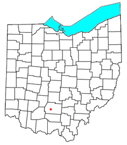
 Location of Bourneville, Ohio | |
| Coordinates: 39°16′58″N 83°09′35″W / 39.28278°N 83.15972°W | |
| Country | United States |
| State | Ohio |
| County | Ross |
| Township | Twin |
| Elevation | 696 ft (212 m) |
| Population | |
| • Total | 241 |
| Time zone | UTC-5 (Eastern (EST)) |
| • Summer (DST) | UTC-4 (EDT) |
| ZIP | 45617 |
| GNIS feature ID | 2628867[1] |
Bourneville is a census-designated place in central Twin Township, Ross County, Ohio, United States. It has a post office with the ZIP code 45617.[3] It lies along U.S. Route 50. The population of the CPD was 241 at the 2020 census.
- ^ a b U.S. Geological Survey Geographic Names Information System: Bourneville, Ohio
- ^ "Bourneville CPD, Ohio - Census Bureau Profile". United States Census Bureau. Retrieved August 12, 2023.
- ^ USPS – Cities by ZIP Code Archived October 10, 2007, at the Wayback Machine