Bouse, Arizona | |
|---|---|
![Gold on hematite from the old Dutchman Mine near Bouse[1]](http://upload.wikimedia.org/wikipedia/commons/thumb/c/c1/Gold-Hematite-164016.jpg/250px-Gold-Hematite-164016.jpg) | |
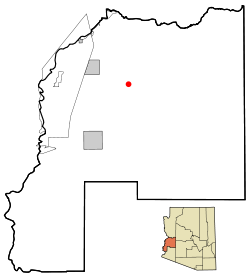
 Location in La Paz County and the state of Arizona | |
| Coordinates: 33°56′1″N 114°0′30″W / 33.93361°N 114.00833°W | |
| Country | United States |
| State | Arizona |
| County | La Paz |
| Area | |
• Total | 136.18 sq mi (352.69 km2) |
| • Land | 136.18 sq mi (352.69 km2) |
| • Water | 0.00 sq mi (0.00 km2) |
| Elevation | 948 ft (289 m) |
| Population (2020) | |
• Total | 707 |
| • Density | 5.19/sq mi (2.00/km2) |
| Time zone | UTC-7 (MST (no daylight saving time)) |
| ZIP code | 85325 |
| Area code | 928 |
| FIPS code | 04-07310 |
| GNIS feature ID | 1887 |
Bouse (/ˈbaʊs/ BOWSS rhymes with "house") is a census-designated place (CDP) and ghost town in La Paz County, Arizona, United States. Founded in 1908 as a mining camp, the economy of Bouse is now based on tourism, agriculture, and retirees.[3] The population was 996 at the 2010 census.[4] It was originally named Brayton after the store owner John Brayton Martin.[5][6]
- ^ "Dutchman Mine (Flying Dutchman Mine), Bouse, Plomosa District, Plomosa Mts, La Paz Co., Arizona, USA". www.mindat.org.
- ^ "2020 U.S. Gazetteer Files". United States Census Bureau. Retrieved October 29, 2021.
- ^ Bouse community profile Archived September 16, 2009, at the Wayback Machine at Arizona Department of Commerce
- ^ "Geographic Identifiers: 2010 Census Summary File 1 (G001), Bouse CDP, Arizona". American FactFinder. U.S. Census Bureau. Archived from the original on February 13, 2020. Retrieved August 15, 2019.
- ^ Heatwole, Thelma (1991) [1951]. Ghost Towns and Historical Haunts in Arizona. Phoenix: American Traveler Press. pp. 15–16 [16]. ISBN 978-0914846109.
- ^ Varney, Philip (1980). "Three: Ghosts of Central-Western Arizona • The Hot Ones". Arizona's Best Ghost Towns. Flagstaff: Northland Press. pp. 39–40. ISBN 0873582179. LCCN 79-91724.
