| Bouvard Mandurah, Western Australia | |||||||||||||||
|---|---|---|---|---|---|---|---|---|---|---|---|---|---|---|---|
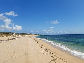
 Tims Thicket Beach in the north-west of Bouvard | |||||||||||||||
 | |||||||||||||||
| Coordinates | 32°40′55″S 115°37′12″E / 32.682°S 115.62°E | ||||||||||||||
| Population | 910 (SAL 2021)[1] | ||||||||||||||
| Established | 1980s | ||||||||||||||
| Postcode(s) | 6211 | ||||||||||||||
| Area | 40.9 km2 (15.8 sq mi) | ||||||||||||||
| Location | |||||||||||||||
| LGA(s) | City of Mandurah | ||||||||||||||
| State electorate(s) | Murray-Wellington | ||||||||||||||
| Federal division(s) | Canning | ||||||||||||||
| |||||||||||||||
Bouvard is the second southernmost suburb of Mandurah, Western Australia, and is 97 kilometres (60 mi) south of the state capital, Perth. Its local government area is the City of Mandurah.
- ^ Australian Bureau of Statistics (28 June 2022). "Bouvard (suburb and locality)". Australian Census 2021 QuickStats. Retrieved 28 June 2022.