Bowmanville | |
|---|---|
 Downtown Bowmanville in 2024 | |
| Coordinates: 43°54′41″N 78°41′15″W / 43.91139°N 78.68750°W | |
| Country | Canada |
| Province | Ontario |
| Regional municipality | Durham |
| Municipality | Clarington |
| Government | |
| • Type | Municipality |
| • Mayor | Adrian Foster |
| Area | |
• Total | 21.7 km2 (8.4 sq mi) |
| Elevation | 150 m (492 ft) |
| Population (May 10, 2016) | |
• Total | 39,371 |
| • Density | 1,814/km2 (4,700/sq mi) |
| Time zone | UTC−5 (EST) |
| • Summer (DST) | UTC−4 (EDT) |
| Forward sortation area | |
| Area code(s) | 905 and 289 |
| NTS Map | 30M15 Oshawa |
| GNBC Code | FDGDW[1] |
| Website | http://www.bowmanville.com |
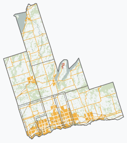
Bowmanville is a town of approximately 40,000 people located in the Municipality of Clarington, Durham Region, Ontario, Canada.[1][2] It is approximately 75 km (47 mi) east of Toronto, and 15 km (9.3 mi) east of Oshawa along Highway 2. Bowmanville was first incorporated as a town in 1858, but later incorporated with the neighbouring townships of Clarke and Darlington in 1974 forming the Town of Newcastle, which was renamed in 1994 to the Municipality of Clarington. Bowmanville is part of the Greater Toronto Area.
- ^ a b "Bowmanville". Geographical Names Data Base. Natural Resources Canada. Retrieved 2012-07-29.
- ^ "Clarington". Statistics Canada. November 2, 2016.

