Boyd, Oregon | |
|---|---|
 Entrance to Boyd, Oregon | |
 | |
| Coordinates: 45°29′21″N 121°04′56″W / 45.4892875°N 121.0822909°W | |
| Country | United States |
| State | Oregon |
| County | Wasco |
| Established | 1861 |
| Disincorporated | 1955 |
| Area | |
| • Total | 0 sq mi (0 km2) |
| Elevation | 1,227 ft (374 m) |
| Population (2006) | |
| • Total | 0 |
| Time zone | UTC-8 (Pacific) |
| • Summer (DST) | UTC-7 (Pacific) |
| ZIP code | 97021 |
| Area codes | 458 and 541 |
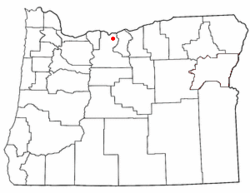
Boyd was a town in Wasco County, Oregon, United States, disincorporated in 1955, and now vacant except for a few abandoned homes, weathered outbuildings, and a derelict wooden grain elevator surrounded by the wheat fields, which still produce the grain that used to fill it. The site was recently[when?] bought and turned into farmland. The site of the former settlement is 9.5 miles (15.3 km) southeast of The Dalles, on the east side of U.S. Route 197 from which it is visible at a distance.