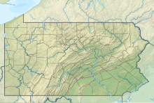
Bradford Regional Airport | |||||||||||||||
|---|---|---|---|---|---|---|---|---|---|---|---|---|---|---|---|
 | |||||||||||||||
| Summary | |||||||||||||||
| Airport type | Public | ||||||||||||||
| Owner | Bradford Regional Airport Authority | ||||||||||||||
| Operator | Bradford Regional Airport Authority | ||||||||||||||
| Serves | Bradford, Pennsylvania | ||||||||||||||
| Location | McKean County, Pennsylvania, U.S. | ||||||||||||||
| Elevation AMSL | 2,143 ft / 653 m | ||||||||||||||
| Coordinates | 41°48′11″N 078°38′24″W / 41.80306°N 78.64000°W | ||||||||||||||
| Website | BradfordAirport.net | ||||||||||||||
| Maps | |||||||||||||||
 Airport diagram | |||||||||||||||
 | |||||||||||||||
| Runways | |||||||||||||||
| |||||||||||||||
| Statistics | |||||||||||||||
| |||||||||||||||
Bradford Regional Airport (IATA: BFD[2], ICAO: KBFD, FAA LID: BFD) is 11 miles (18 km) south of Bradford, in Lafayette Township,[3] McKean County, Pennsylvania.[1] It has scheduled airline service subsidized by the Essential Air Service program.
The airport is owned by the Bradford Regional Airport Authority[1] and serves Pennsylvania and western New York including Olean, New York. There is an armory at the airport for the National Guard.
The National Plan of Integrated Airport Systems for 2021–2025 categorized it as a non-primary commercial service airport (between 2,500 and 10,000 enplanements per year).[4]
- ^ a b c FAA Airport Form 5010 for BFD PDF. Federal Aviation Administration. effective April 21, 2022.
- ^ "IATA Airport Code Search (BFD: Bradford)". International Air Transport Association. Retrieved June 5, 2014.
- ^ "2020 CENSUS - CENSUS BLOCK MAP: Lafayette township, PA" (PDF). U.S. Census Bureau. Retrieved 2024-09-09.
Bradford Regional Arprt
- ^ "2011–2015 NPIAS Report, Appendix A" (PDF). National Plan of Integrated Airport Systems. Federal Aviation Administration. October 4, 2010. Archived from the original (PDF, 2.03 MB) on 2012-09-27.

