| Bramdean | |
|---|---|
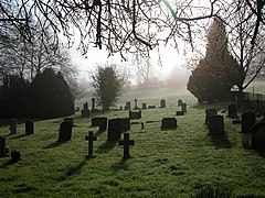
 Churchyard of St. Simon and St. Jude, Bramdean | |
Location within Hampshire | |
| OS grid reference | SU6128 |
| Civil parish | |
| District | |
| Shire county | |
| Region | |
| Country | England |
| Sovereign state | United Kingdom |
| Post town | Alresford |
| Postcode district | SO24 |
| Dialling code | 01962 |
| Police | Hampshire and Isle of Wight |
| Fire | Hampshire and Isle of Wight |
| Ambulance | South Central |
| UK Parliament | |
Bramdean is a village and former civil parish, now in the parish of Bramdean and Hinton Ampner, in the Winchester district, in the county of Hampshire, England. It is a linear settlement located along the busy A272 trunk road which was widened by the American troops in 1943 in preparation for D-Day.[1]
The village itself is peculiar due to the large number of large houses dating from the Georgian period. A few of these are set in or near beautiful rolling parkland with specimen trees.
A number of hamlets are also situated within the boundaries of the parish. To the north of the village is Bramdean Common, known for its good walks and pretty cottages. Further settlements include Little London, Hinton Woodlands, Hells Bottom (or Wolfhanger), and Joans Acre.
