| Branco River | |
|---|---|
 | |
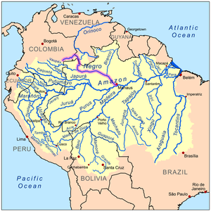
 The Branco River is a tributary of the Rio Negro (highlighted on map) | |
| Native name | Rio Branco (Portuguese) |
| Location | |
| Country | |
| Physical characteristics | |
| Source | |
| • location | confluence of Takutu and Uraricoera, Roraima, Brazil |
| • coordinates | 3°1′28.5276″N 60°29′14.8596″W / 3.024591000°N 60.487461000°W |
| • elevation | 64 m (210 ft) |
| 2nd source | |
| • location | Uraricoera, Parima Mountains |
| • coordinates | 3°41′42.2484″N 64°12′36.018″W / 3.695069000°N 64.21000500°W |
| • elevation | 1,240 m (4,070 ft) |
| 3rd source | |
| • location | Takutu, Guiana Shield |
| • coordinates | 1°47′48.6492″N 60°1′38.2656″W / 1.796847000°N 60.027296000°W |
| • elevation | 306 m (1,004 ft) |
| Mouth | |
• location | Rio Negro, Roraima, Brazil |
• coordinates | 1°23′38″S 61°50′46″W / 1.39389°S 61.84611°W |
• elevation | 12 m (39 ft) |
| Length | 560 km (350 mi)[2] to 775 km (482 mi)[3] |
| Basin size | 192,392.66 km2 (74,283.22 sq mi)[4] |
| Discharge | |
| • location | Confluence of Rio Negro, Roraima |
| • average | (Period:1967-2010)5,400 m3/s (190,000 cu ft/s)[4]
(Period: 1980-2006)5,300 m3/s (190,000 cu ft/s)[6] (Period: 1998-2022)6,469 m3/s (228,500 cu ft/s)[5] |
| • minimum | 278 m3/s (9,800 cu ft/s)[5] |
| • maximum | 28,697 m3/s (1,013,400 cu ft/s)[5] |
| Discharge | |
| • location | Caracaraí (400 km upstream of mouth; Basin size: 124,980 km2 (48,260 sq mi) |
| • average | (Period: 1997/01/01-2015/12/31)
3,170.343 m3/s (111,959.6 cu ft/s)[7] (Period: 1998-2022)3,615.65 m3/s (127,685 cu ft/s)[4] |
| • minimum | 178 m3/s (6,300 cu ft/s) (1998/03/24)[4] |
| • maximum | 15,735 m3/s (555,700 cu ft/s) (1976/07/10)[4] |
| Discharge | |
| • location | Boa Vista (Basin size: 97,200 km2 (37,500 sq mi) |
| • average | (Period: 1967-2010)2,436.76 m3/s (86,053 cu ft/s)[4] (Period: 1998-2022)3,129.97 m3/s (110,534 cu ft/s)[4] |
| Basin features | |
| Tributaries | |
| • left | Takutu, Anauá, Itapará |
| • right | Uraricoera, Mucajai, Ajarani, Univini, Catrimani, Xeruini |
The Branco River (Portuguese: Rio Branco; Engl: White River) is the principal affluent of the Rio Negro from the north.
- ^ UOL. Turismo em Boa Vista. Archived 2016-03-03 at the Wayback Machine Access on Feb 17 2012.
- ^ Ziesler, R.; Ardizzone, G.D. (1979). "Amazon River System". The Inland waters of Latin America. Food and Agriculture Organization of the United Nations. ISBN 92-5-000780-9. Archived from the original on 8 November 2014.
- ^ "Branco-River". Archived from the original on 2023-02-17. Retrieved 2023-03-10.
- ^ a b c d e f g "Amazon basin water resources observation service". Archived from the original on 2023-09-08. Retrieved 2023-03-10.
- ^ a b c "River Discharge and Reservoir Storage Changes Using Satellite Microwave Radiometry". Archived from the original on 2023-03-10. Retrieved 2023-03-10.
- ^ Seyler, Patrick; Laurence Maurice-Bourgoin; Jean Loup Guyot. "Hydrological Control on the Temporal Variability of Trace Element Concentration in the Amazon River and its Main Tributaries". Geological Survey of Brazil (CPRM). Archived from the original on 21 July 2011. Retrieved 24 July 2010.
- ^ Jamie, Towner (2019). "Assessing the performance of global hydrological models for capturing peak river flows in the Amazon basin" (PDF). Archived (PDF) from the original on 2023-10-14. Retrieved 2023-03-10.