Brickell
Southside (historic) | |
|---|---|
 The Brickell skyline as seen from the Rickenbacker Causeway, December 2020 | |
| Nickname: Financial District | |
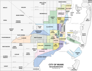
 Brickell neighborhood within the City of Miami | |
| Coordinates: 25°45′29″N 80°11′35″W / 25.758°N 80.193°W | |
| Country | United States |
| State | Florida |
| County | Miami-Dade County |
| City | Miami |
| Settled | 1830s |
| Incorporated into the City of Miami | 1896 |
| Government | |
| • City of Miami Commissioner | Ken Russell (D) |
| • Miami-Dade Commissioners | Eileen Higgns (D) |
| • House of Representatives | Nicholas Duran(D) |
| • State Senate | Ileana Garcia (R) |
| • U.S. House | Maria Elvira Salazar (R) |
| Area | |
| • Total | 1.19 sq mi (3.1 km2) |
| Elevation | 10 ft (3 m) |
| Highest elevation | 25 ft (8 m) |
| Lowest elevation | 0 ft (0 m) |
| Population (2010)[1] | |
| • Total | 32,489 (2,014 DDA estimate) |
| • Density | 27,302/sq mi (10,541/km2) |
| • Demonym | Brickellite |
| Time zone | UTC-05 (EST) |
| ZIP Code | 33129, 33130, 33131 |
| Area code(s) | 305, 786 |
| Website | Brickell Homeowners Association |
Brickell (/ˈbrɪkəl/ BRIK-əl) is a neighborhood in Miami, Florida, historically referenced at times as "Southside" (being south of the Miami River), located directly east of Interstate 95, south of the Miami River, and north of Coconut Grove. Brickell is known as the financial district of Miami, as well as South Florida.
Brickell was founded in the mid-19th century, growing to become Miami's "Millionaire's Row" in the early 20th century after the construction of lavish mansions along Brickell Avenue by Mary Brickell; both the avenue and neighborhood were named for Mary Brickell and her husband, William Brickell.[2] By the 1970s, office towers, hotels and apartments began replacing the historic mansions. Brickell overtook the city's central business district to the north, as one of the largest financial districts in the United States. With a fast-growing residential population, Brickell is Miami's most dense neighborhood, with a 2024 population of about 40,000.[3][4][5]
- ^ "2014 Demographics Report" (PDF). Downtown Development Authority. Archived from the original (PDF) on January 25, 2015. Retrieved November 17, 2015.
- ^ Munzenreider, Kyle (January 28, 2016). "The Stories Behind the Names of 25 Miami-Dade Cities and Neighborhoods". Miami New Times. Retrieved January 24, 2021.
- ^ "Brickell - Miami, FL". Niche. Retrieved October 23, 2024.
- ^ "Urban Stats". urbanstats.org. Retrieved October 23, 2024.
- ^ Sands, Roger. "Neighborhood To Watch: Brickell, Miami". Forbes. Retrieved October 23, 2024.