| Bridge Canyon Dam | |
|---|---|
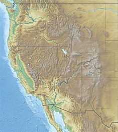
 Map showing the Bridge and Marble Canyon Dam projects | |
| Country | United States |
| Location | Mohave County, Arizona |
| Coordinates | 35°48′53″N 113°34′01″W / 35.81472°N 113.56694°W |
| Status | Proposed |
| Construction cost | $500 million (est.) |
| Owner(s) | U.S. Bureau of Reclamation |
| Dam and spillways | |
| Impounds | Colorado River |
| Height | 740 ft (230 m) |
| Length | 1,700 ft (520 m) |
| Reservoir | |
| Creates | Bridge Canyon Reservoir |
| Total capacity | 3,710,000 acre⋅ft (4.58 km3)[1] |
| Catchment area | 140,000 sq mi (360,000 km2) |
| Surface area | 24,000 acres (9,700 ha) |
| Normal elevation | 1,866 ft (569 m)[1] |
| Power Station | |
| Hydraulic head | 672 ft (205 m) |
| Installed capacity | 1,500 MW[1] |
| Annual generation | 5.36 billion KWh[1] |
Bridge Canyon Dam, also called Hualapai Dam, was a proposed dam in the lower Grand Canyon of the Colorado River, in northern Arizona in the United States. It would have been located near Bridge Canyon Rapids in an extremely rugged and isolated portion of the canyon, 235 miles (378 km) downstream of Lees Ferry and at the uppermost end of Lake Mead.
First proposed in the 1920s, the project was seriously considered by the U.S. Bureau of Reclamation for a period of over twenty years from the early 1950s to 1968. If built, the dam would have stood 740 feet (230 m) high, forming a reservoir stretching more than ninety miles (140 km) upstream, including thirteen miles (21 km) along the border of Grand Canyon National Park. The dam would serve mainly for hydropower production in conjunction with several others further upstream including Marble Canyon Dam, on the Colorado, Green and other rivers.
Due to its enormous potential for environmental destruction and the dwindling flows of the Colorado River, the project stalled in 1968 after years of public opposition. However, the location is considered one of the best remaining sites for a large dam in the western United States.
- ^ a b c d "1964 Pacific Southwest Water Plan initial report" (PDF). Archived from the original (PDF) on 2012-09-27. Retrieved 2012-11-18.
