| Brisbane Airport Brisbane, Queensland | |||||||||||||||
|---|---|---|---|---|---|---|---|---|---|---|---|---|---|---|---|
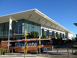
 Skygate Village and bus | |||||||||||||||
| Coordinates | 27°23′36″S 153°06′48″E / 27.3933°S 153.1133°E | ||||||||||||||
| Population | 0 (2016 census)[1] | ||||||||||||||
| • Density | 0.000/km2 (0.00/sq mi) | ||||||||||||||
| Postcode(s) | 4008 | ||||||||||||||
| Area | 33.4 km2 (12.9 sq mi) | ||||||||||||||
| Time zone | AEST (UTC+10:00) | ||||||||||||||
| Location | 14 km (9 mi) from Brisbane CBD | ||||||||||||||
| LGA(s) | City of Brisbane (Hamilton Ward)[2] | ||||||||||||||
| State electorate(s) | Clayfield | ||||||||||||||
| Federal division(s) | Lilley | ||||||||||||||
| |||||||||||||||
Brisbane Airport is a coastal suburb in the City of Brisbane, Queensland, Australia.[3] In the 2016 census, Brisbane Airport had a population of 0 people.[1]
Brisbane Airport is located approximately 14 kilometres (9 mi) north-east from the Brisbane central business district. The majority of the land is occupied by the Brisbane Airport. Airport Drive and Moreton Drive link the airport with the Gateway Motorway.
- ^ a b Cite error: The named reference
Census2016was invoked but never defined (see the help page). - ^ "Hamilton Ward". Brisbane City Council. Archived from the original on 12 March 2017. Retrieved 19 March 2017.
- ^ "Brisbane Airport – suburb in City of Brisbane (entry 47581)". Queensland Place Names. Queensland Government. Retrieved 26 December 2020.
