Broadmoor | |
|---|---|
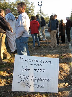
 Broadmoor Lives! Post Katrina rally | |
 | |
| Coordinates: 29°56′56″N 90°06′15″W / 29.94889°N 90.10417°W | |
| Country | United States |
| State | Louisiana |
| City | New Orleans |
| Planning District | District 3, Uptown/Carrollton |
| Area | |
• Total | 0.56 sq mi (1.5 km2) |
| • Land | 0.56 sq mi (1.5 km2) |
| • Water | 0.00 sq mi (0.0 km2) |
| Elevation | 2 ft (0.6 m) |
| Population (2010) | |
• Total | 2,378 |
| • Density | 4,200/sq mi (1,600/km2) |
| Time zone | UTC-6 (CST) |
| • Summer (DST) | UTC-5 (CDT) |
| Area code | 504 |
Broadmoor Historic District | |
| Location | Roughly bounded by South Broad/Fountainebleau, Milan, S. Claiborne and Octavia, New Orleans, Louisiana (original) Roughly bounded by Walmsley, S. White, Eden, and S. Jefferson Davis Pkwy, (increase) New Orleans, Louisiana |
|---|---|
| Coordinates | 29°56′48″N 90°6′22″W / 29.94667°N 90.10611°W |
| Architectural style | Bungalow/Craftsman, Colonial Revival, et al. (original) Colonial Revival, Bungalow/Craftsman (increase) |
| NRHP reference No. | 03000519 and 07000940[1] |
| Added to NRHP | June 13, 2003 (original) September 13, 2007 (increase) |
Broadmoor is a neighborhood of the city of New Orleans. A subdistrict of the Uptown/Carrollton Area, its boundaries as defined by the New Orleans City Planning Commission are: Eve Street to the north, Washington Avenue and Toledano Street to the east, South Claiborne Avenue to the south, and Jefferson Avenue, South Rocheblave Street, Nashville Avenue, and Octavia Street to the west. It includes the Broadmoor Historic District which was listed on the National Register of Historic Places in 2003 and increased in its boundaries in 2007.[1]
- ^ a b "National Register Information System". National Register of Historic Places. National Park Service. April 15, 2008.

