| Brocks Gap Dam | |
|---|---|
| Country | United States |
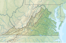
| Coordinates | 38°38′38.42″N 78°51′49.24″W / 38.6440056°N 78.8636778°W |
| Status | Unbuilt |
| Construction cost | $11,640,000 (1963) |
| Owner(s) | U.S. Army Corps of Engineers |
| Dam and spillways | |
| Type of dam | Earthfill |
| Impounds | North Fork of the Shenandoah River |
| Height | 147 ft (45 m) |
| Length | 860 feet (260 m) |
| Spillway type | Unregulated overflow |
| Reservoir | |
| Total capacity | 187,200 acre-feet (0.2309 km3) |
| Surface area | 2,810 acres (1,140 ha) |

Brocks Gap Dam was a never-built proposal for a water storage dam on the North Fork of the Shenandoah River at Brocks Gap in northwest Virginia. The proposal by the U.S. Army Corps of Engineers encountered opposition from local residents and was withdrawn in 1967.
