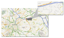
Bromford, referred to locally as "the Bromford", is an industrial and residential area of Birmingham, situated between Ward End, Alum Rock, Hodge Hill, Washwood Heath, Shard End, Stechford, Castle Bromwich and Tyburn. The industrial area is predominantly situated on the north side of the M6 motorway, including The Bromford Gate industrial park, Fort Shopping Park, and Fort Dunlop, with one industrial site sitting east of the M6 called Bromford Central. The residential area sits adjacent to the East of the M6 comprising two neighbourhoods, Bromford (formally referred to as Bromford Bridge) built along Bromford Drive, and The Firs built along Chipperfield Road. The industrial and residential areas have increasingly become two separate distinguishable places, and not recognised locally as joined or one. This is signified by the M6 & River Tame dividing the two areas, poor public transport links between the two areas, and the areas sitting within three different local authority wards (industrial being split between Gravelly Hill and Pype Hayes, and the residential situated within Bromford & Hodge Hill), and two parliamentary constituencies (industrial area situated within Birmingham Erdington and residential area situated within Birmingham Hodge Hill and Solihull North .

