Brookline, Massachusetts | |
|---|---|
 Intersection of Harvard and Beacon Streets in the Coolidge Corner neighborhood of Brookline | |
 | |
| Coordinates: 42°19′54″N 71°07′18″W / 42.33167°N 71.12167°W | |
| Country | |
| State | |
| County | Norfolk |
| Region | New England |
| Settled | 1638 |
| Incorporated | 1705 |
| Government | |
| • Type | Representative town meeting |
| • Town Administrator | Charles Carey |
| • Select Board | Bernard Greene (Chair) John VanScoyoc (Vice-Chair) Michael Sandman Paul Warren David Pearlman |
| Area | |
| • Total | 6.8 sq mi (17.7 km2) |
| • Land | 6.8 sq mi (17.6 km2) |
| • Water | 0.1 sq mi (0.1 km2) |
| Elevation | 50 ft (15 m) |
| Population (2020) | |
| • Total | 63,191 |
| • Density | 9,292.8/sq mi (3,590.4/km2) |
| Time zone | UTC−5 (Eastern) |
| • Summer (DST) | UTC−4 (Eastern) |
| ZIP Codes | 02445–02447, 02467 |
| Area code | 617/857 |
| FIPS code | 25-09175 |
| GNIS feature ID | 0619456 |
| Website | www |
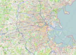
Brookline (/ˈbrʊklaɪn/ ) is a town in Norfolk County, Massachusetts, United States, and part of the Boston metropolitan area. An exclave of Norfolk County, Brookline borders six of Boston's neighborhoods: Brighton, Allston, Fenway–Kenmore, Mission Hill, Jamaica Plain, and West Roxbury. The city of Newton borders Brookline to the west. It is known for being the birthplace of John F. Kennedy.
The land which comprises what is today Brookline was first settled in 1638 as a hamlet in Boston, known as Muddy River (as it was settled on the west side of the river of the same name). It was incorporated as a separate town with the name of Brookline in 1705. In 1873, Brookline had a contentious referendum in which it voted to remain independent from Boston. The later annexations of Brighton and West Roxbury, both in 1874, and that of Hyde Park in 1912, eventually made Brookline into an exclave of Norfolk County. The town has a history of racial discrimination in zoning, which has led to a disproportionately wealthy population and a very low percentage of Black residents, at only 2.5%.
Several streets and railroads were laid out in the town in the 19th century. Today, these are Massachusetts Route 9 (locally "Boylston St", which cuts the town in two) and the various branches of the MBTA's Green Line. To the north of Route 9, the area is fairly urban; the southern part is much less so.
At the time of the 2020 census, the population of the town was 63,191.[1] It has been the most populous municipality in Massachusetts to have a town (rather than city) form of government since Framingham changed to a city in 2018, following a 2017 referendum.[2]
- ^ "U.S. Census Bureau Quickfacts: United States". Census.gov.
- ^ "Framingham votes to become a city". Massachusetts Municipal Association (MMA). April 5, 2017. Retrieved March 11, 2023.


