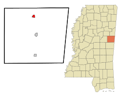
Brooksville, Mississippi | |
|---|---|
 Location of Brooksville, Mississippi | |
| Coordinates: 33°13′58″N 88°34′54″W / 33.23278°N 88.58167°W | |
| Country | United States |
| State | Mississippi |
| County | Noxubee |
| Area | |
• Total | 1.59 sq mi (4.12 km2) |
| • Land | 1.59 sq mi (4.12 km2) |
| • Water | 0.00 sq mi (0.00 km2) |
| Elevation | 279 ft (85 m) |
| Population (2020) | |
• Total | 915 |
| • Density | 575.83/sq mi (222.36/km2) |
| Time zone | UTC-6 (Central (CST)) |
| • Summer (DST) | UTC-5 (CDT) |
| ZIP code | 39739 |
| Area code | 662 |
| FIPS code | 28-08980 |
| GNIS feature ID | 0667603 |
| Website | www |
Brooksville is a town in Noxubee County, Mississippi, United States. The population was 1,223 at the 2010 census.
The Sam D. Hamilton Noxubee National Wildlife Refuge is located west of the town, and the Black Prairie Wildlife Management Area is located to the north.[2]
- ^ "2020 U.S. Gazetteer Files". United States Census Bureau. Retrieved July 24, 2022.
- ^ "Black Prairie". Mississippi Department of Wildlife, Fisheries and Parks. Archived from the original on May 14, 2014. Retrieved March 2, 2014.
