Brothers, Oregon | |
|---|---|
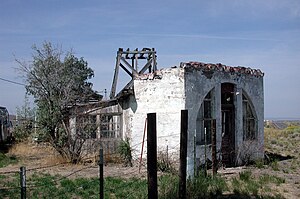
 Ruins in Brothers | |
 | |
| Coordinates: 43°48′49″N 120°36′12″W / 43.81361°N 120.60333°W | |
| Country | United States |
| State | Oregon |
| County | Deschutes |
| Elevation | 4,639 ft (1,414 m) |
| Time zone | UTC-8 (PST) |
| • Summer (DST) | UTC-7 (PDT) |
| ZIP code | 97712 |
| Area code(s) | 458 and 541 |
| Coordinates and elevation from United States Geological Survey[1] | |

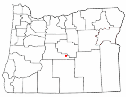
Brothers is an unincorporated community in Deschutes County, Oregon, United States on U.S. Route 20. It is part of the Bend, Oregon Metropolitan Statistical Area. It lies at an elevation of 4,639 feet (1,414 m) above sea level.[1]
- ^ a b "Brothers". Geographic Names Information System. United States Geological Survey. November 28, 1980. Retrieved August 23, 2009.