Brough Aerodrome | |||||||||||||||
|---|---|---|---|---|---|---|---|---|---|---|---|---|---|---|---|
 | |||||||||||||||
| Summary | |||||||||||||||
| Airport type | Private | ||||||||||||||
| Operator | BAE Systems | ||||||||||||||
| Location | Brough, East Riding of Yorkshire | ||||||||||||||
| Elevation AMSL | 12 ft / 4 m | ||||||||||||||
| Coordinates | 53°43′11″N 000°33′59″W / 53.71972°N 0.56639°W | ||||||||||||||
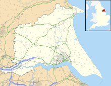
| Map | |||||||||||||||
| Runways | |||||||||||||||
| |||||||||||||||
Brough Aerodrome (ICAO: EGNB) was a private use aerodrome located at Brough, East Riding of Yorkshire, England. It is now disused with the last known flight out of the airfield occurring in 2011. The airfield closed in 2013. The site is now crossed by a new road "Baffin Way" serving the town.[3]
- ^ "Airport information for EGNB". World Aero Data. Archived from the original on 5 March 2019.
{{cite web}}: CS1 maint: unfit URL (link) Data current as of October 2006. Source: DAFIF. - ^ Airport information for EGNB at Great Circle Mapper. Source: DAFIF (effective October 2006).
- ^ "Historic runway at Brough Aerodrome will disappear under the path of new £6.5m link road". The Yorkshire Post. Retrieved 30 May 2021.
