| Broulee New South Wales | |||||||||||||||
|---|---|---|---|---|---|---|---|---|---|---|---|---|---|---|---|
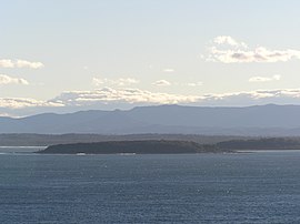
 Broulee Island looking south from Burri Point | |||||||||||||||
| Coordinates | 35°51′26″S 150°10′44″E / 35.8572°S 150.1789°E | ||||||||||||||
| Population | 1,947 (SAL 2021)[1] | ||||||||||||||
| Postcode(s) | 2537 | ||||||||||||||
| LGA(s) | Eurobodalla Shire | ||||||||||||||
| County | Dampier | ||||||||||||||
| Parish | Broulee | ||||||||||||||
| State electorate(s) | Bega | ||||||||||||||
| Federal division(s) | Gilmore | ||||||||||||||
| |||||||||||||||


Broulee is a town on the south coast of New South Wales between Batemans Bay and Moruya.[2][3] At the 2016 census, the town had a population of 1,717.[4] Just off the beach is Broulee Island, currently joined to the mainland, but in past years the connecting spit has been covered by water, at times a very deep navigable channel with a strong current.
The first harbour in the area south of Batemans Bay was established at Broulee behind what is now known as the island. Although settlement had already commenced on the shores of the nearby Moruya River, it was not easily navigable due to a sandbar at its mouth.
- ^ Australian Bureau of Statistics (28 June 2022). "Broulee (suburb and locality)". Australian Census 2021 QuickStats. Retrieved 28 June 2022.
- ^ "Broulee". Geographical Names Register (GNR) of NSW. Geographical Names Board of New South Wales. Retrieved 31 January 2018.
- ^ "Broulee". OpenStreetMap. Retrieved 31 January 2018.
- ^ Australian Bureau of Statistics (27 June 2017). "Broulee (state suburb)". 2016 Census QuickStats. Retrieved 8 July 2017.
