Brownton, Minnesota | |
|---|---|
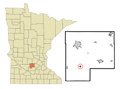
 Location in McLeod County and the state of Minnesota | |
| Coordinates: 44°43′57″N 94°21′03″W / 44.73250°N 94.35083°W | |
| Country | United States |
| State | Minnesota |
| County | McLeod |
| Area | |
• Total | 0.40 sq mi (1.04 km2) |
| • Land | 0.40 sq mi (1.04 km2) |
| • Water | 0.00 sq mi (0.00 km2) |
| Elevation | 1,030 ft (310 m) |
| Population | |
• Total | 731 |
| • Density | 1,818.41/sq mi (702.94/km2) |
| Time zone | UTC-6 (Central (CST)) |
| • Summer (DST) | UTC-5 (CDT) |
| ZIP code | 55312 |
| Area code | 320 |
| FIPS code | 27-08254[4] |
| GNIS feature ID | 2393442[2] |
| Website | www |
Brownton is a city in McLeod County, Minnesota, United States. The population was 731 at the 2020 census.[3]
- ^ "2023 U.S. Gazetteer Files: Minnesota". United States Census Bureau. Retrieved January 10, 2024.
- ^ a b U.S. Geological Survey Geographic Names Information System: Brownton, Minnesota
- ^ a b "P1. Race – Brownton city, Minnesota: 2020 DEC Redistricting Data (PL 94-171)". U.S. Census Bureau. Retrieved January 10, 2024.
- ^ "U.S. Census website". United States Census Bureau. Retrieved January 31, 2008.